RADAR vs. LIDAR ... Which is Right for You?
What piece of LE equipment uses technology invented over half a century ago yet is still in daily use to help keep your community safe? It’s your RADAR gun, and LIDAR isn’t that much younger.
RADAR (Radio Detection and Ranging), was developed during World War II and LIDAR (Light Detection and Ranging) was developed in the 1960s. In 1989, Jeremy Dunne of Laser Technology Inc. developed a police LIDAR device and LIDAR was taking ten percent of law enforcement speed detection sales after the turn of the century. If RADAR and LIDAR systems use 50+-year-old technology, what possibly could be new?
Manufacturers have incorporated the latest supporting electronics and software into their RADAR and LIDAR units, making them more powerful yet easier to use than older units. Software is also available which runs on a laptop both to configure the units and to download and report on the data. This advanced software lets today’s RADAR and LIDAR units be force multipliers, speeding up data gathering and building easy to read reports. Officers can spend more time in the field instead sitting at a desk converting hundreds of data points into something that city staff and the public can understand.
Choosing the right technology for your speed detection program depends on your agency’s mission and staffing. From least to most manpower intensive, these missions are: Determining if you have a problem or developing a baseline; automated detection and traffic calming; and finally, citing offenders. With literally hundreds of options available, should your agency choose RADAR or LIDAR and which specific unit should you buy?
First steps
Most agencies don’t have enough personnel or budget to address every speeding report with a pair of eyes attached to an officer not to mention the cost of training before an officer even arrives. The National Highway Traffic Safety Administration (NHTSA) has put certification standards into place for RADAR & LIDAR operators. An officer must be able to estimate a vehicle’s speed on his own and then use the RADAR or LIDAR unit to reinforce and document his estimate before they are allowed to operate the devices and issue citations.
Manned systems cost a lot in hardware, staff time and training, while automated speed detection devices are available for as low as a few thousand dollars. Choosing the right one for your agency depends on your agency’s needs.
For writing citations, the main difference and the advantage of LIDAR over RADAR is that the beam divergence (how fast the beam spreads with distance) is much lower. The divergence at 1,000 feet from the average RADAR unit is 250 feet (76m) versus 3 feet (1m) for LIDAR. Thus, LIDAR allows targeting of a specific vehicle—and without triggering RADAR/LIDAR detectors in other vehicles nearby. However, this is a disadvantage when your mission is setting a baseline or traffic calming because it cannot capture vehicles which are spread over a large area.
Whether RADAR or LIDAR, you should look for handhelds which have tough drop-proof housings, protective bumpers, are IP67 water and dust proof and have displays bright enough for daytime use but can be dimmed for nighttime use. Intuitive touch-screen menu controls can make using a handheld easier, but you will need a display which works with gloves. Instead, you may want a unit with physical buttons which may be easier to use, but perhaps less intuitive than buttons on a display.
Unmanned RADAR systems
Automated systems using one or more detectors are perfect for this mission. Since you are not targeting a specific vehicle but want to watch vehicles over a broad area, a RADAR-based system is the best choice due to its’ high divergence which allows it to “see” all of the cars on the road. Unlike older “rubber tube” systems installing and configuring a RADAR system can be done either by, pulling in a trailer or by mounting a box on a streetlight or utility pole, in seconds.
Brendan Thompson, Sales Manager for JAMAR Technologies, says to start out with a covert detector in order to get a baseline. Charlie Robeson, Director of Sales and Marketing for Radarsign agrees that baselining should be done first.
If baselining is the objective, you have a choice of systems which are in a nondescript box or ones which have displays which show a driver’s speed and perhaps an informational message. You want to disable the speed display and flashing lights for a few days so that you don’t slow down drivers while you are baselining.
Some examples of pole-mounted boxes are the JAMAR Technologies Gen II and Black Cat II devices, which are designed to not be out of place mounted on a utility pole or streetlight. Once mounted, the officer can calibrate the units from their patrol car using Bluetooth on a laptop. Calibration includes “aiming” the beams and setting up multilane detection (Black Cat II) and single- or multi-direction data capture. These advanced units can tell you that there were 75 vehicles heading in one direction, 25 in the other, how fast each one was going and whether they are cars, box trucks or semis. The Black Cat II can tell you how many vehicles were in each lane heading in the same direction of a multi-lane street.
Radarsign offers pole-mounted models which can be read from 450, 600 and 1,000 feet. Which unit you buy depends on the speed limit of the roadway where they are being used. Higher speed means that you need a longer reading distance and therefore a larger display.
Maybe you want a sign that just displays the driver’s current speed or some other type of sign. Robeson says, “People put their brain on autopilot when driving and a sign brings them back to a more attentive mental state so that they slow down. Flashing radar speed signs even get ‘super speeders’ to reduce to a slower and safer speed.” Robeson says there may be special cases, such as a tech campus, factory, shipping yard or school zone, where you want a crossing guard to wheel out a small ‘your speed is…’ display at the beginning of their shift. “Then they can wheel it back and plug it in when not in use.”
Manned RADAR systems
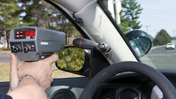
You can purchase convertible handheld/vehicle-mounted units which support stationary use, or moving use. For hand-held use, look for units which can be powered/charged by the vehicle or operated from internal regular or rechargeable batteries.
Jeff Wheeler, Marketing Coordinator for MPH Industries says several of their units can be separated into the base unit, antennas and display to create the optimal configuration for a specific mission. Some units be either handheld or mounted to the dash. Others allow you to mount RADAR antennas on multiple vehicles and swap the base unit between cars as needed. This flexibility helps agencies save money by dynamically repurposing units for the mission at hand.
Their Ranger EZ not only will lock on to both your strongest and your fastest targets, it uses a color-coded display to tell you how far away each one is, making it faster to visually locate lawbreakers. This function is also useful for concealment so that you know how soon a target will pass and whether it is a car or truck. It is often important to look for anti-detector technology to measure speeds without alerting the detectors.
LIDAR
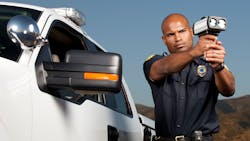
LIDAR systems have a very small spread, and need to be aimed with a viewfinder. Speed estimation takes less than half a second, which, together with the narrow, targeted beam, results in offending vehicles having little warning even when using a detector. Additionally, some LIDAR units can measure the distance between vehicles to allow for following too close citations to be issued.
An electronic viewfinder, which is driven by a camera, allows for information to be displayed along with the image. Look for units with customizable aiming reticles, speed/distance and other operational information which can help make the job easier. Units with cameras can capture the vehicle image including license plate and other appropriate information.
If you purchase a unit with a camera, ensure that there is an approved end-to-end chain of custody system which will prevent or detect image alteration. Most of these will implement some kind of image signing and encryption so that the image only can be accessed by appropriate personnel and cannot be modified.
Software
One of the strengths of modern RADAR and LIDAR systems are the software packages for data collection and tagging and the PC-based software used for transferring, collating and reporting on the collected data.
Radarsign’s signs keep a database of incidents which can be downloaded through a secure Wi-Fi connection via a laptop from up to 200 feet away. Their Streetsmart Traffic Data Collection and Reporting software allows collection of speeds and traffic patterns letting you show minimum/maximum speeds and the number of speeders. Timestamping allows officers to know exactly when there is a problem and what the problem is so that command staff can make intelligent use of limited resources.
JAMAR’s bundled StarneXt software and report writer create reports for presentation to the brass, city council members or the public. The software is drag and drop simple with colorful and readable charts along with the ability to filter by time of day and vehicle type. The reports are live, so the officer can see immediate results as he or she makes modifications. If drivers actually are behaving themselves, you can use the reports to prove that to the RP. If drivers are slightly over the limit you may want to move to automated traffic calming. If drivers are reckless you may want to jump directly to citations. The baseline measurements will allow you to objectively assess whatever solution you decide to implement.
Laser Technology’s TruVISION images are protected using industry-standard encryption and placed into a proprietary file type, preventing unauthorized viewing or modification. The bundled PC-based LaserTech Clip Viewer software decrypts and displays the images. The departing mode indicates the vehicle traveling away from the unit with a minus sign in front of the speed.
There are hundreds of LIDAR and RADAR choices available to you, which allow you to run a baseline, perform unmanned detection and warning of speeders and finally to issue citations to bring them under control. Which combination of products to implement depends on your training and purchasing budgets along with your mission goals. Advanced software can act as a force multiplier, lowering manpower requirements and helping to justify your traffic programs. Don’t just ask what software is available but insist on an ease of use demonstration.
Every vendor has one or more success stories where their product was used to lower the average speed, reduce collisions and fatalities and make an agency’s officers more effective enforcers. Don’t hesitate to talk to ask for both success stories and for the names of agencies where the vendor tried but didn’t make a sale.
Every agency is different with different skillsets and different needs. Finding out why a specific solution did or didn’t work for another agency should be a large part of your own acquisition process.

Ron LaPedis
Ron LaPedis has been a business continuity and security professional for over 25 years and frequently writes and speaks on business continuity, cybersecurity, physical security and public safety topics. He is a life member of the NRA, NRA-certified Range Safety Officer (RSO), NRA and California DOJ Certified Instructor, member of the International Law Enforcement Educators and Trainers Association (ILEETA), and serves on the boards of public safety, military and law-enforcement related organizations. Ron is a Master Business Continuity Professional (MBCP), an Associate Fellow of the Business Continuity Institute (AFBCI), a Distinguished Fellow of the Ponemon Institute and a Certified Information Systems Security Professional (CISSP).


